Abstract
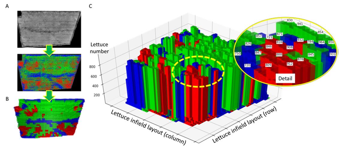
Aerial imagery is regularly used by farmers and growers to monitor crops during the growing season. To extract meaningful phenotypic information from large-scale aerial images collected regularly from the field, high-throughput analytic solutions are required, which not only produce high-quality measures of key crop traits, but also support agricultural practitioners to make reliable management decisions of their crops. Here, we report AirSurf-Lettuce, an automated and open-source aerial image analysis platform that combines modern computer vision, up-to-date machine learning, and modular software engineering to measure yield-related phenotypes of millions of lettuces across the field. Utilising ultra-large normalized difference vegetation index (NDVI) images acquired by fixed-wing light aircrafts together with a deep-learning classifier trained with over 100,000 labelled lettuce signals, the platform is capable of scoring and categorising iceberg lettuces with high accuracy (>98%). Furthermore, novel analysis functions have been developed to map lettuce size distribution in the field, based on which global positioning system (GPS) tagged harvest regions can be derived to enable growers and farmers' precise harvest strategies and marketability estimates before the harvest.
Link to the article: https://www.biorxiv.org/content/10.1101/527184v1